
Pedro Point Headlands Wildfire Resilience and Evacuation Route Improvement Projects
Notice: Sanctioned trails at Pedro Point Headlands are now fully accessible, as hazard tree removal work has ended for the Fall 2026 season.
Project Summary
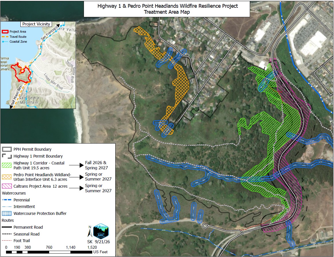
San Mateo Resource Conservation District (RCD) is managing a multi-pronged effort to reduce wildfire risk, manage invasive species, and protect a critical evacuation route in the vicinity of the Pedro Point Headlands and Devil’s Slide near Pacifica, CA. In partnership with Caltrans, the State Coastal Conservancy, the City of Pacifica, and Pacifica Land Trust, the projects will involve vegetation management along a 0.8-mile stretch of Highway 1 immediately north of the Tom Lantos (Devil’s Slide) tunnels, which is a critical evacuation corridor for communities along San Mateo County’s Midcoast. Vegetation management will also occur on public lands adjacent to the Pedro Point neighborhood to reduce the cover of invasive eucalyptus, remove hazard trees, and reduce the risk of wildfire. Additional work will occur throughout the Pedro Point Headlands to manage invasive plants, enhance and encourage habitat for fire-resilient native plant species, and improve coastal prairie and coastal scrub habitat conditions. This work is funded by the California State Coastal Conservancy (SCC), Caltrans, and San Mateo County Measure K.
We presented about this project at the Pedro Point Firehouse in Pacifica! Watch here:Hwy 1 and Pedro Point Wildfire Resiliency Community Presentation – August 31, 2026 – YouTube
Frequently Asked Questions
When will this project start?
This project is expected to start in October 2026. Caltrans anticipates beginning vegetation removal work within their ROW in spring/summer 2027. Public outreach events will occur to provide information and updates as they become available. To learn more or to be included in invites to public meetings contact the Project Manager, Erin Andrew, at erin@sanmateoRCD.org.
Why does this project need to happen?
Just south of the City of Pacifica, dense stands of flammable, non-native trees and brush occur at Pedro Point Headlands, with vegetation bordering private parcels behind the Pedro Point neighborhood. These conditions create a potential pathway for wildfire to spread from open space into the adjacent neighborhood, where it could threaten homes, infrastructure, evacuation, and public safety if left untreated. The adjacent Highway 1 corridor is a primary emergency evacuation route for communities along the Midcoast of San Mateo County. This stretch of highway is also occupied by dense, invasive vegetation.
The project area is identified as a High Fire Hazard Severity Zone by CAL FIRE, and there is potential for wildfire ignitions to spread rapidly if this area is left untreated. By reducing hazardous vegetative fuels and invasive species, the project will reduce overall wildfire risk, lower ignition potential, and mitigate other risks to the highway, such as treefall during winter storms, all of which improves community safety.
What can I expect when this critical work is taking place?
Noise from vegetation removal work may be heard depending on your proximity to the project area while the work is occurring. Chainsaws, pole saws and a chipper may be heard during standard work hours (M-F, 8-5).
Trail closures at the Headlands will occur as necessary for public safety. Signage will be posted on the trails to indicate closures, and City of Pacifica and State Coastal Conservancy will post closures on their websites in advance.
For information on traffic impacts, see below.
What traffic impacts can I expect?
One-lane closures are likely during the Caltrans work within their ROW approximately during the 9-3 pm Monday – Friday excluding holidays starting this summer over a 2-3 week period. Caltrans will notify the public about these closure periods. For more information, contact Pedro Quintana, Caltrans Office of Public Affairs Branch Chief: Pedro.Quintana@dot.ca.gov. You can sign up to receive traffic advisories for the project here: https://lp.constantcontactpages.com/sl/0J3vikr
Or use the QR code provided:

Caltrans D4 Fuel Reduction Projects at SR-1 & SR-92 in San Mateo County | Caltrans
How will the RCD and Caltrans protect the environment?
In March 2025, Governor Newsom proclaimed a statewide emergency to help fast-track critical wildfire prevention and fuels reduction projects. The work at Pedro Point Headlands and along Highway 1 near Devil’s Slide has been approved for this streamlined process as a critical project to reduce wildfire risk. While this process accelerates permitting, the project must still follow the Statewide Fuels Reduction Environmental Protection Plan, which includes protective measures for sensitive habitats and wildlife, water quality, erosion control, Tribal cultural resources, coastal resources, and public access. Learn more about the Environmental Protection Plan.
For more information, contact Erin Andrew, Project Manager: erin@sanmateoRCD.org



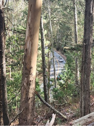
Highway 1 taken from the Pedro Point Headlands. Note the dense tree assemblages. Photo taken by Erin Andrew.
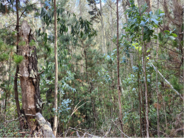
Dense eucalyptus with Monterey pine mixed in at Pedro Point Headlands (photo taken by Erin Andrew)