Pescadero Marsh Habitat Restoration and Resiliency Project
![]()
![]()
Updated May 2025
Overview
The Resource Conservation District (RCD) and State Parks are restoring how water and sediment move between Pescadero Creek, marsh areas, the lagoon estuary, and the ocean to reverse harm done by humans over many decades and ensure a healthier ecosystem. The project is also removing non-native invasive species and increasing habitat complexity to improve conditions for wildlife.
This work will improve water quality in the marsh and lagoon, increase freshwater and brackish (mixed salt and fresh water) habitat for multiple native fish and wildlife species, and will help the marsh be more resilient to sea level rise and a changing climate. The project will reconnect the Sequoia-Audobon Trail, parts of which have been inaccessible due to erosion.
Location
Work is taking place in the northern areas of Pescadero Marsh State Natural Preserve east of Highway 1.
Project Goals
- Reduce potential for creation and transport of hypoxic to anoxic water into the lagoon during breach events. Address salinity, stratification, and drainage efficiencies that are relics of past land use
- Reduce salinity and restore brackish to freshwater habitats in the North Marsh North Pond, where feasible.
- Lower levees, where possible, to increase freshwater flood inundation
- Reduce drainage efficiency from the northern and southern drainage ditches.
- Thin the eucalyptus forest to increase watershed inflows and reduce and evapotranspiration
- Remove human-made infrastructure affecting the natural hydrology and sediment transport regime, where possible including levees, drainage ditches, and culverts.
- Improve the ability of the lagoon to freshen during closure.
- Increase inflows into the lagoon from Pescadero and Butano Creek via streamflow protection measures.
- Reduce volume of “lagoon” during initial closure via hydrologic disconnection of North Marsh North Pond.
- Ensure that changes to the North Marsh North Pond do not impact the ability of the lagoon to scour and transport sand through the system and into the ocean.
- Implement actions that will allow the process and function of the system to evolve naturally.
- Assess at two temporal scales: near term (0–25 years) and then long term (25–100 years) based on climate change predictions of sea level rise and possibly runoff/inflows.
Activities
- Remove culverts in eight locations, six of which are defunct.
- Excavate and lower some levees in key locations.
- Fill channel and ditch with excavated material.
- Install thirty-eight natural features (wood structures) on the surface of the marsh, in Pescadero Creek, and embedded in the filled channels and ditches.
- Remove some invasive eucalyptus and iceplant.
- Revegetate some disturbed areas with native plants.
- Restore the Sequoia-Audubon Trail as a lower levee trail.
Funders
- State Parks
- NOAA Restoration Center
Schedule
- May 2025: begin upland construction
- June 2025: begin in-water construction
- October 2025: complete construction, commence monitoring
Project Maps and Photos
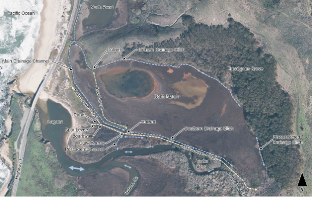
Photo 1. Aerial of the entire project site with nomenclature to help viewers orient.
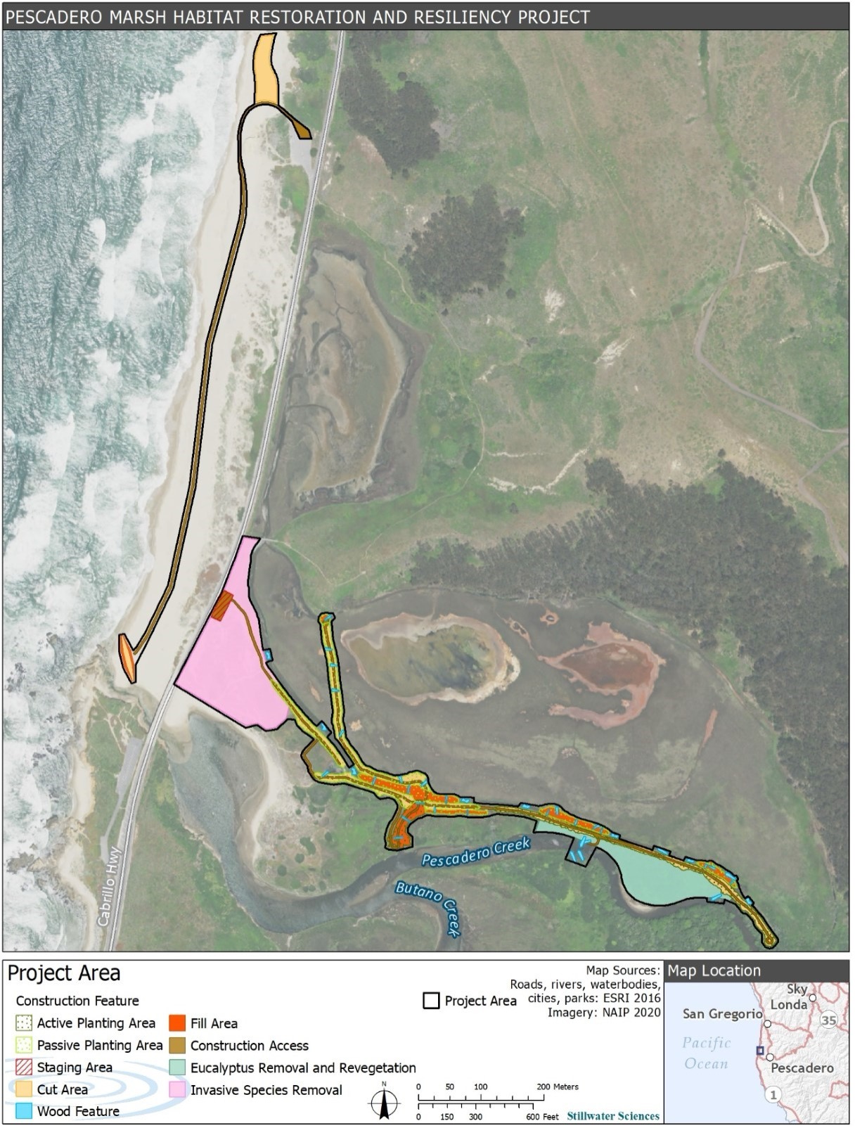
Figure 1. Overview of project designs and work areas.
Photo 2. Main drainage channel at bend in background of Photo 3 looking westward at low tide. North Marsh in on the right and levee is on the left.
Photo 3. Main drainage at high tide, looking east. North marsh is on the left and the main levee is on the right.
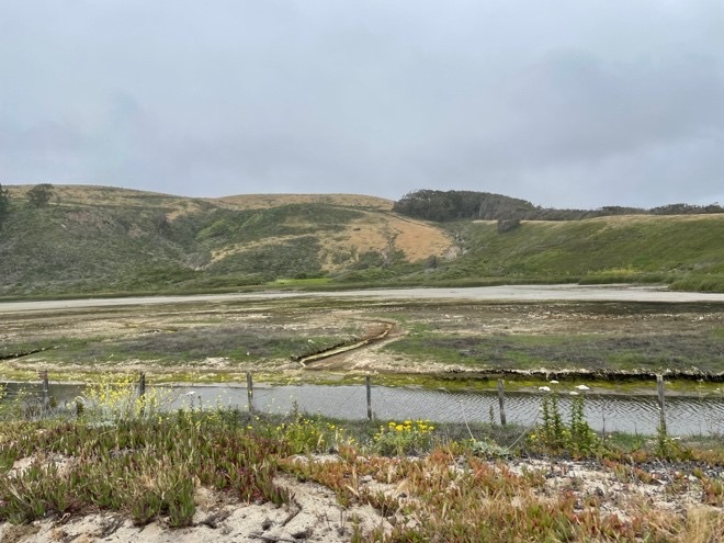
Photo 4. Looking east at the North Pond in the during open bar conditions. Small drainage channel has formed between pond and Main Drainage Channel.
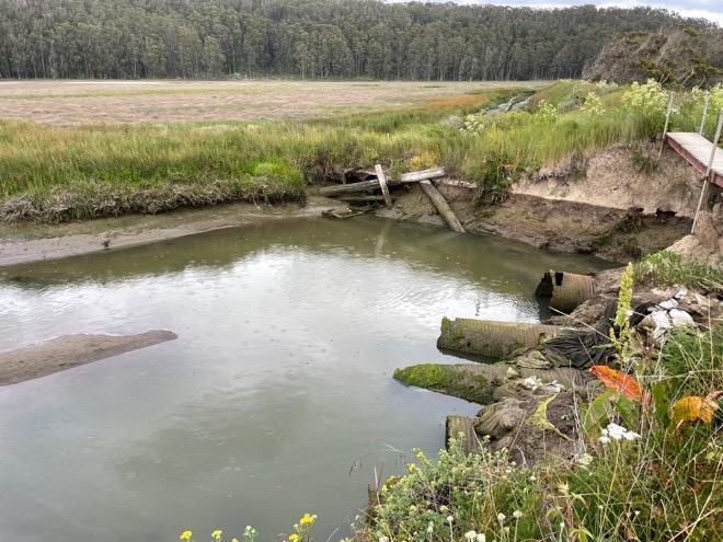
Photo 5. Looking northeast from Sequoia-Audubon Trail at various relic/defunct culverts. Culverts on the right are draining to Pescadero Channel and culver in the upper center is draining the South Drainage Ditch.
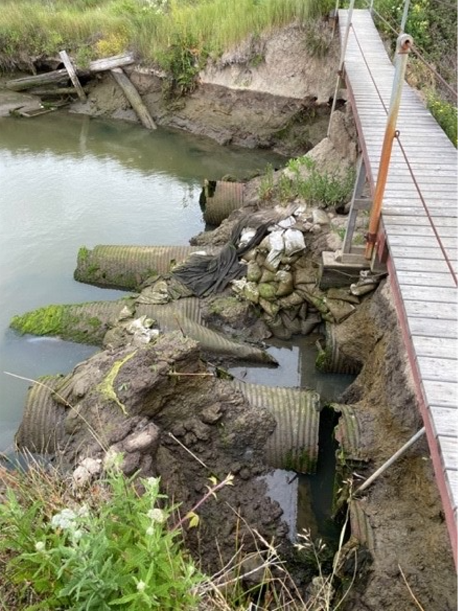
Photo 6. Walking bridge over derelict culverts prior to recent failures.
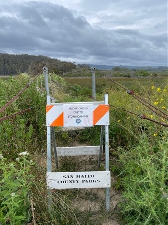
Photo 7. Sign closing the trail to public access due to condition of the levee at this culvert.
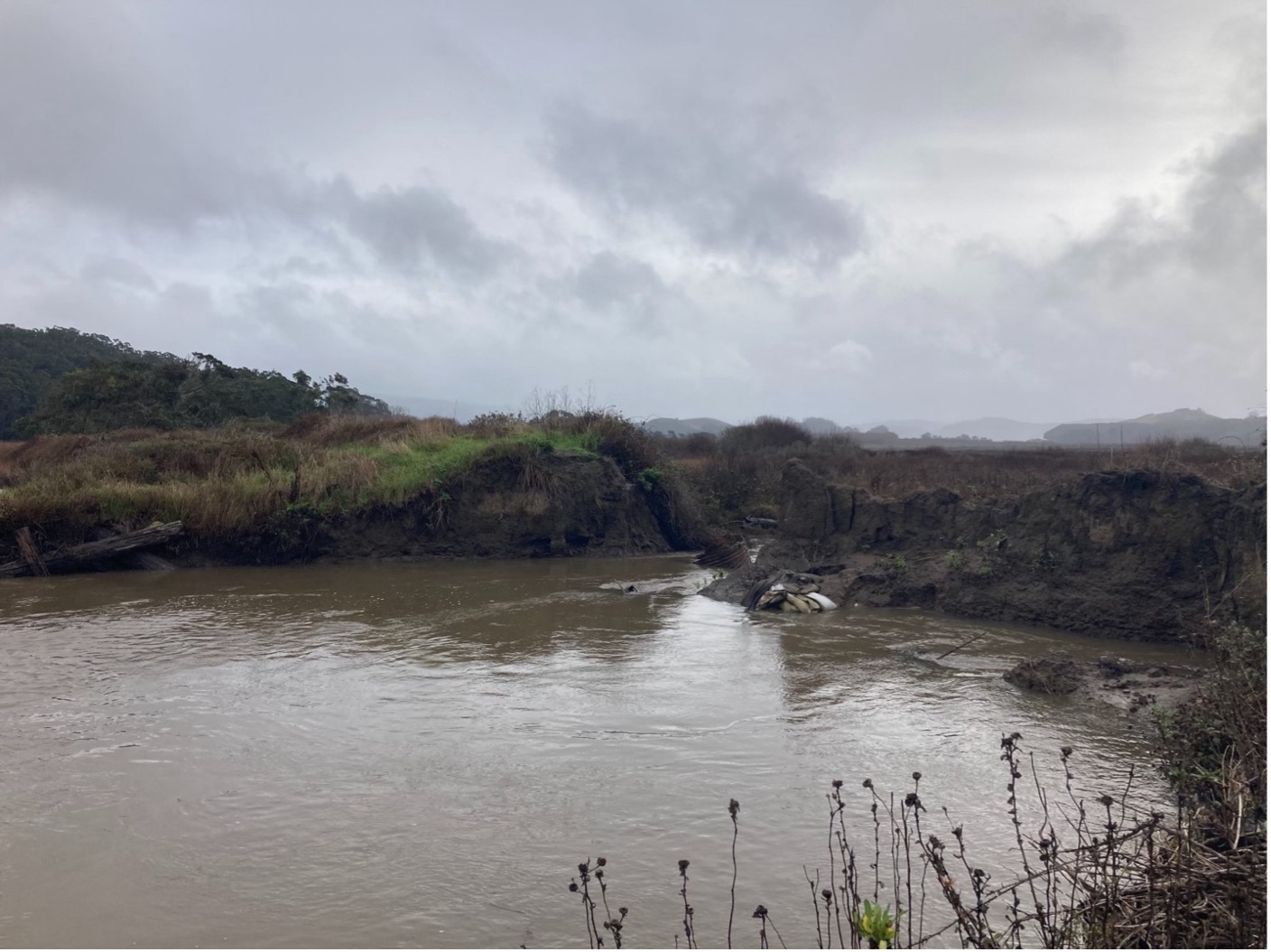
Photo 8. Taken on January 24, 2024 at the site of the culvert array and levee shown in Photos 5 and 6. The entire levee, culvert array, and temporary bridge have officially blown out.